Firebaugh Airport (FAA LID: F34), formerly Q49, is a public airport located one mile (1.6 km) west of Firebaugh, serving Fresno County, California, United States. It is mostly used for general aviation.
Facilities
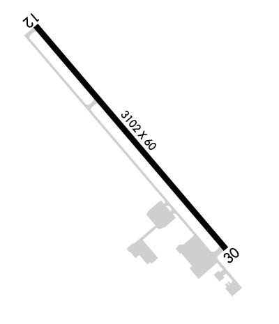
Firebaugh Airport covers 37 acres and has one runway:
- Runway 12/30: 3,102 x 60 ft (945 x 18 m), surface: asphalt
References
- FAA Airport Form 5010 for F34 PDF
External links
- Resources for this airport:
- FAA airport information for F34
- AirNav airport information for F34
- FlightAware airport information and live flight tracker
- SkyVector aeronautical chart for F34